Sometimes you just want a clear, simple map of where a project sits and what is around it. This is that guide for Bhartiya City KIADB in Devanahalli, North Bangalore. It lays out the key landmarks nearby, the main roads that serve the project, and approximate travel times to the places that matter — so you can picture the location at a glance before you visit.
You can review the project itself on the Bhartiya City KIADB project page at Perfect Neighbourhood. Now, the location map in words.
Where Bhartiya City KIADB Sits on the Map
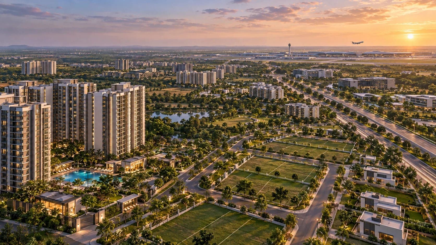
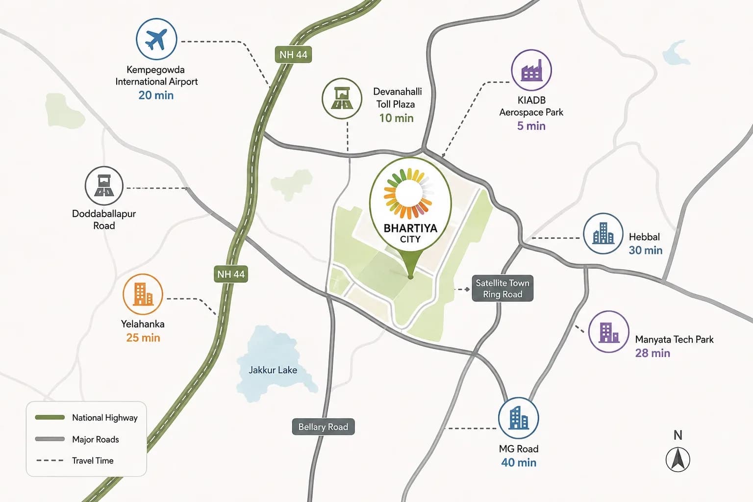
Bhartiya City KIADB is located in the KIADB Aerospace Park area of Devanahalli, in the northern part of Bangalore. This is the airport growth corridor — the belt of land that runs alongside and around Kempegowda International Airport.
The simplest way to picture it: the project sits north of the main city, close to the airport, within a planned zone built around aerospace, business and knowledge industries. The main highway, NH 44 (Bellary Road), runs alongside this corridor and connects it to the rest of Bangalore.
Key Landmarks Near Bhartiya City KIADB
Here are the important places around the project, grouped by type.
Airport: Kempegowda International Airport — the single closest major landmark, and the biggest draw of the location.
Employment hubs: KIADB Aerospace Park (right in the zone), plus Embassy Knowledge Park, IFCI Financial City and Manyata Tech Park within the wider corridor.
Schools: Stonehill International School and Canadian International School, two well-known international schools in North Bangalore.
Hospitals: Aster CMI Hospital and Manipal Hospital Hebbal (formerly Columbia Asia), reachable along the main highway toward the city.
Nearby areas: Yelahanka, a more established suburb, and Hebbal, a major junction and hub, both toward the city side.
The Roads That Serve Bhartiya City KIADB
A location map is only as useful as the roads that connect it. Bhartiya City KIADB is served by three key routes.
NH 44 (Bellary Road): The main highway spine. It runs north–south, linking the project to Hebbal, Manyata and the city in one direction, and toward the airport belt in the other.
Airport Expressway: A fast road built for quick, smooth travel to and from the airport. This is what keeps the airport drive short.
Namma Metro Blue Line (coming soon): A new metro train line planned along the airport corridor. Once it opens, it will add a train option alongside the roads.
Approximate Travel Times From Bhartiya City KIADB
Here are indicative travel times to key places. Please read the important note underneath — these are approximate and change a lot with traffic. Kempegowda International Airport is roughly 15 minutes away. The KIADB Aerospace Park is right in the zone, only a few minutes away. Yelahanka is around 25 minutes, and Hebbal is roughly 25 to 30 minutes. Manyata Tech Park is about 30 minutes, while the city centre around MG Road is a longer, traffic-dependent journey.
Important note on travel times: These figures are approximate and indicative only. Real travel times in Bangalore change significantly depending on the time of day, the exact route and traffic conditions. A drive that takes 15 minutes off-peak can take much longer during morning and evening rush hours. Always check the live drive time on a maps app, from the exact project location to your own destinations, at the times you would actually travel, before making any decision. Treat the numbers above as a rough guide, not a promise.
How to Read the Location Map
Putting it all together, here is the simple picture. Bhartiya City KIADB sits in the airport corridor of North Bangalore. Its strongest connection is to the airport — close and quick. Its job hubs are mostly nearby or along the same corridor. The city and the tech belt are reachable via NH 44, but those are the longer, more traffic-affected journeys.
So the location map tells a clear story: this is a home base built around the airport and the northern employment zone, with the rest of the city a longer drive away. If your life points north and toward the airport, the map works strongly in your favour.
What the Map Means for Different Buyers
The same location map reads differently depending on your life.
For airport-focused buyers — frequent flyers, aviation staff, NRIs — the map is excellent, with the airport just minutes away.
For nearby-zone workers — people employed in the aerospace, business or knowledge parks — the map means a short, easy commute.
For city or tech-belt commuters — those heading daily to central, south or east Bangalore — the map means longer, traffic-dependent journeys, which is an honest consideration.
Tips for Using the Map Before You Buy
A location map is a starting point, not the final word. To use it well, do a few simple things. Open a maps app and check the real drive times from the project to your workplace, your children's school and other places you visit often. Do this at the times you would actually travel, not just off-peak. And, best of all, visit the site in person to feel the location, the roads and the surroundings for yourself. A map on a screen is helpful, but standing there tells you the truth.
Final Word on the Bhartiya City KIADB Location Map
The Bhartiya City KIADB location map is easy to sum up: a home in North Bangalore's airport corridor, anchored by a quick airport connection, surrounded by employment hubs, schools and hospitals, and served by NH 44, the Airport Expressway and a coming metro line. The travel times are strongest toward the airport and the nearby zone, and longer toward the city and tech belt. Use the landmarks and approximate times here as your starting picture — then confirm the real drive times yourself and visit in person before you decide.
To explore the project in full — with current pricing, floor plans and RERA help — review the complete details on the Bhartiya City KIADB project page.
Labels: Bhartiya City KIADB Location Map, Devanahalli Landmarks, North Bangalore Travel Times, KIADB Connectivity, Bhartiya City KIADB Location